TOPOGRAPHICAL SURVEYS
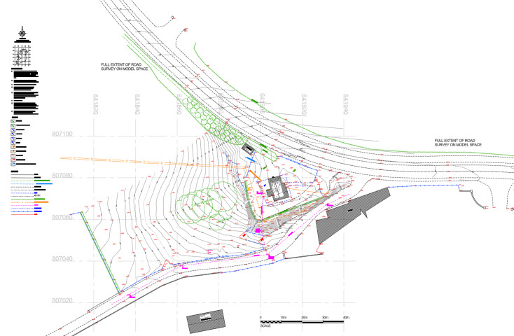
Accurate plans of land/sites for site layout design to ITM coordinate system in a range of CAD formats. Surveys include all natural and man made features on sites and topography including contours and spot levels at required intervals. Accurate site plans suitable for Architects and designers to design site layout drawings for planning and construction purposes.


MEASURED BUILDING SURVEYS
Accurate and detailed building surveys in various CAD formats.
VOLUMES ANALYSIS
If undertaking major excavation works we can provide conduct surveys of before and after ground surface topographical surveys and provide volumes reports illustrating cut and fill and net volumes.
We can also provide sectional drawings through the site illustrating ground profiles.


BOUNDARY LOCATION
If you have a folio number and need a boundary location marked/checked on the ground we can liase with the Property Registration Authority (PRAI) to procure ITM coordinates for use with percision GPS to locate your boundary accurately on the ground.

